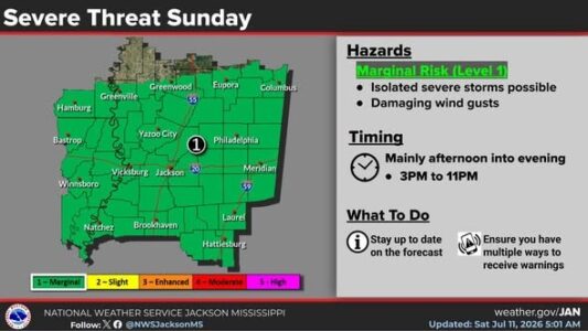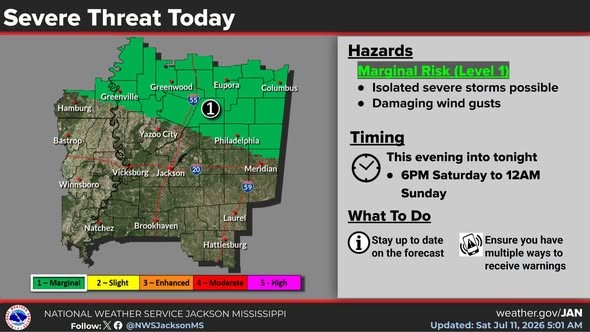
Storms could be moving into this part of central Mississippi tonight and developing again on Sunday. There’s a Level-1 “marginal” risk of isolated severe storms with damaging wind gusts. The National Weather Service says heavy downpours and frequent lightning will also be possible. Rain chances will continue next week at least through Wednesday.
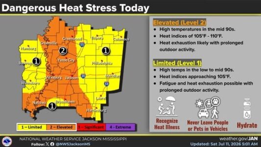
With the storms not expected to arrive until the evening hours today, temperatures will climb into the mid 90s resulting in another day of heat stress. In most local areas, the heat index this afternoon should stay below 105 degrees but in western Mississippi it could reach 110. After today, though, rain and clouds should keep high temperatures from going above the upper 80s for several days.