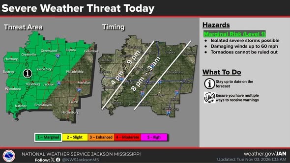
A cold front moving into Mississippi will trigger some strong thunderstorms later today and tonight. And most of the local area remains under a Level-1 “marginal” risk of severe weather, including damaging winds and the possibility of a few brief tornadoes.
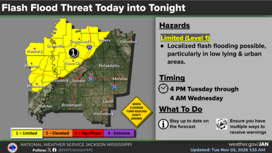
Flash flooding is another concern for parts of the area with the heaviest rain forecast along and northwest of the Natchez Trace.