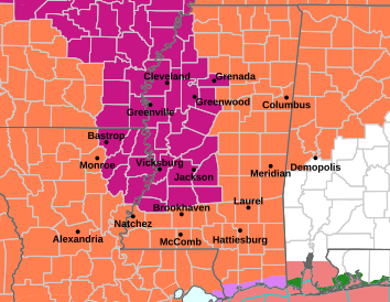
HEAT ADVISORY shown in orange on map above
EXTREME HEAT WARNING shown in purple
Although most of the local area will remain under a heat advisory through Tuesday night, an extreme heat warning has been expanded to the east to cover Holmes and Carroll counties from 10 am until 9 pm on Tuesday.
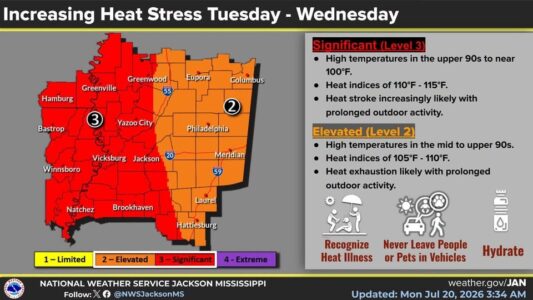
Afternoon highs are forecast in the mid 90s in Philadelphia through Wednesday and in the upper 90s in Kosciusko, Carthage and Durant. Add in the humidity, and we’ll get heat index readings ranging from 106 in Kosciusko and Philadelphia today to 107 in Carthage and 109 in Durant. The heat stress ramps up on Tuesday with heat indices from 107 in Philadelphia to 108 in Kosciusko, 109 in Carthage and 111 in Durant. Wednesday won’t be much better as the heat index is forecast to top out at 107 in Kosciusko and Philadelphia, 108 in Carthage and 111 in Durant.
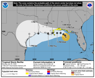
Meanwhile, Tropical Storm Bertha has formed in the northeastern Gulf but the current forecast keeps the center of the storm offshore as it moves westward past the Mississippi coast toward Louisiana on Wednesday. A tropical storm watch and a storm surge watch have been issued for the Mississippi coast.