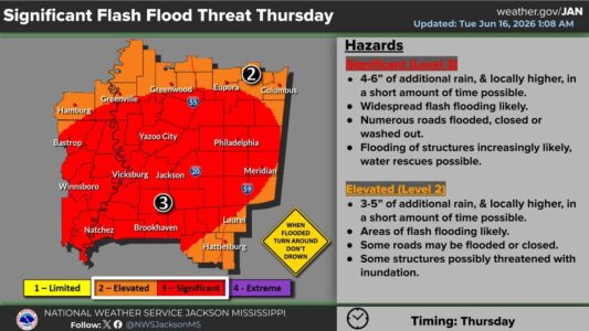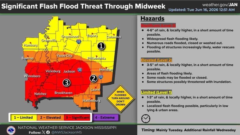
This part of central Mississippi will continue to be near the edge of the heaviest rainfall today and tomorrow with growing concerns about flash flooding in the local area later this week. The National Weather Service is forecasting four to six inches of rain through tomorrow from the Jackson area south with one to three inches possible in this area. But the threat of significant flash flooding is expected to spread north on Thursday with four to six inches of rain possible over a much larger part of the state including most of the local area.
Also on Thursday, a few isolated severe storms will be possible with a weak tornado risk across Mississippi. A Level-1 “marginal” risk has been posted.